1. What Is a Flood?
At its most basic, a flood occurs when water covers land that is normally dry. However, the mechanisms that drive water out of its natural containment are highly variable. No two floods are identical, even within the same catchment. Following heavy rain, water behaves according to the laws of physics and topography, flowing rapidly from higher elevations towards the sea. The way this runoff moves determines the nature of the crisis.
2. Riverine Flooding
Riverine flooding is the most widespread form of flooding in Australia. It occurs when sustained, heavy rainfall across a catchment causes rivers and creeks to exceed their capacity and overflow their banks. Because large river systems collect water from immense areas, riverine floods can take days or even weeks to peak, moving slowly across the landscape like a vast inland sea.
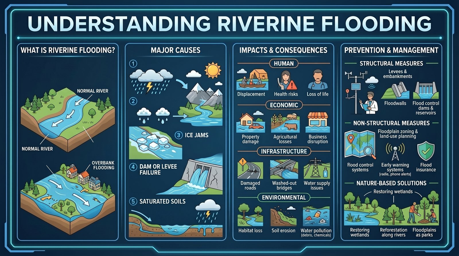
In Queensland, these floods are frequently driven by monsoonal systems or decaying tropical cyclones that park over the state, dumping continuous rain. Once the soils within the catchment reach saturation, they can absorb no more water. From this point, almost all subsequent rainfall becomes runoff, rapidly swelling the river channels.
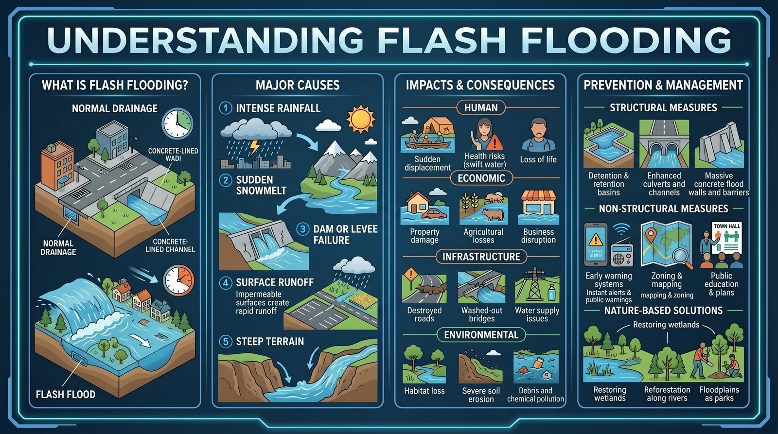
3. Flash Flooding and Overland Flow
While riverine floods are slow-moving, a flash flood is defined by its speed. These occur when extreme rainfall causes water to rise rapidly, typically within six hours of the weather event. They are incredibly dangerous because they offer virtually no warning time.
Urban areas are exceptionally vulnerable to flash flooding due to the high proportion of impervious surfaces like concrete and asphalt. When the stormwater drainage systems are overwhelmed, the water follows the path of least resistance across the urban landscape—a phenomenon known as overland flow. During the 2022 Brisbane floods, overland flow devastated thousands of properties that had survived the 2011 riverine floods entirely unscathed.
4. Storm Tides and Coastal Flooding
In coastal cities, the threat comes not just from rain, but from the ocean. When severe weather systems like cyclones push towards the coast, their low barometric pressure and fierce onshore winds physically push the ocean surface higher. This creates a storm surge.
However, the total danger is defined by the storm tide—the combination of the storm surge and the normal astronomical tide.
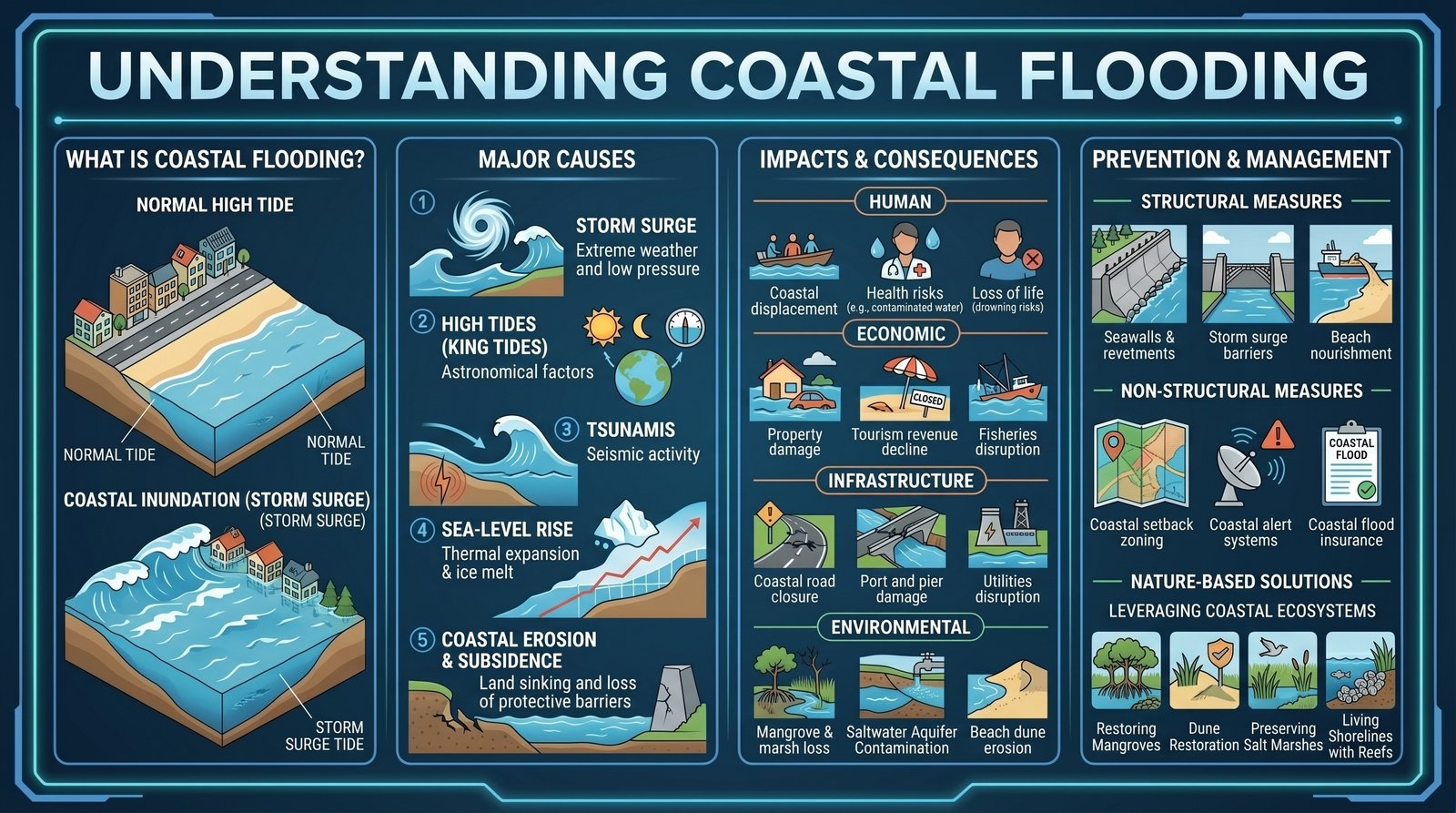
If a two-metre storm surge arrives at low tide, the impact might be minimal. If that identical surge arrives at the peak of a high spring tide, it can inundate coastal suburbs, pushing saltwater far inland and completely halting the drainage of flooded rivers.[2]
5. Dam-Related Flooding
Major dams in South East Queensland, such as Wivenhoe and Somerset, were built for two purposes: to secure the region's drinking water supply and to provide flood mitigation. Dam-related flooding usually occurs when operators are forced to make controlled water releases to protect the structural integrity of the dam during extreme, prolonged rain events.
It is a common misconception that a dam can "stop" a major flood. As the Queensland Reconstruction Authority has repeatedly stated: